Latest Highlights
Great collaboration with Soneva Fushi, NRC and the Soneva Foundation in the Maldives!
Completed a great two weeks of fieldwork on Kunfunadhoo Island (Soneva Fushi), Baa Atoll, Republic of the Maldives collecting data for terrestrial and aquatic biodiversity conservation.
Kalacska, Arroyo-Mora, Lucanus, Jahir, Weideli, Allahgholi, Shivdasani, 2023, "RPAS 3D model of Kunfunadhoo Island (Soneva Fushi), Baa Atoll, Republic of the Maldives", Borealis, V1
Check out the LiDAR model here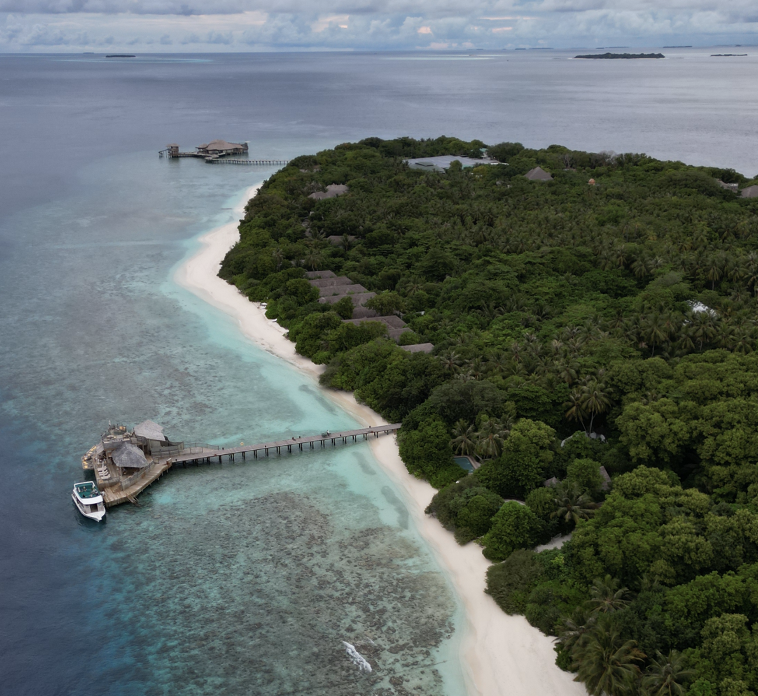
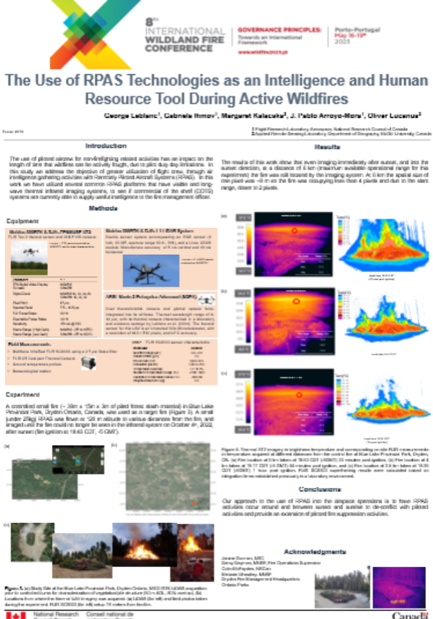
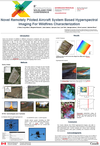
8th International Wildland Conference!
We will be presenting our collaborative work with NRC, the Canadian Forest Service, the Ontario Ministry of Natural Resources and Forestry, the Portuguese Airforce and NATO Science and Technology Organization.
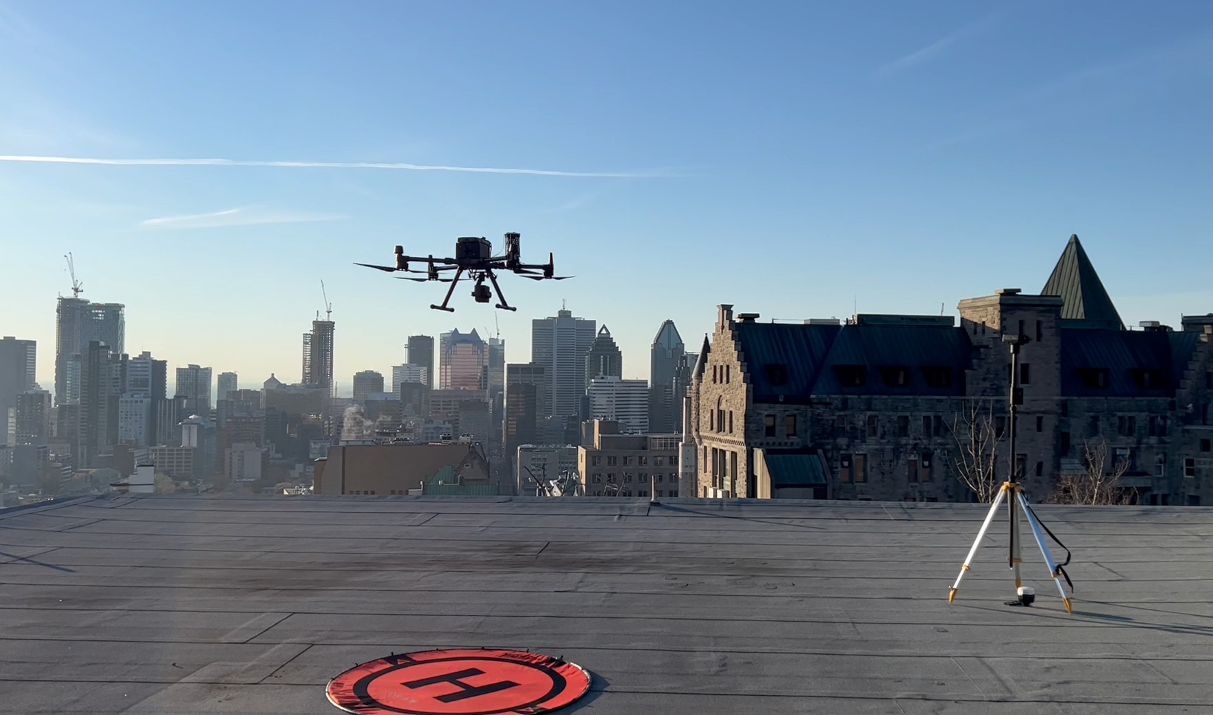
Successful field trial of a Drone Rescue Systems parachute for our M300 for complex flights in urban areas!
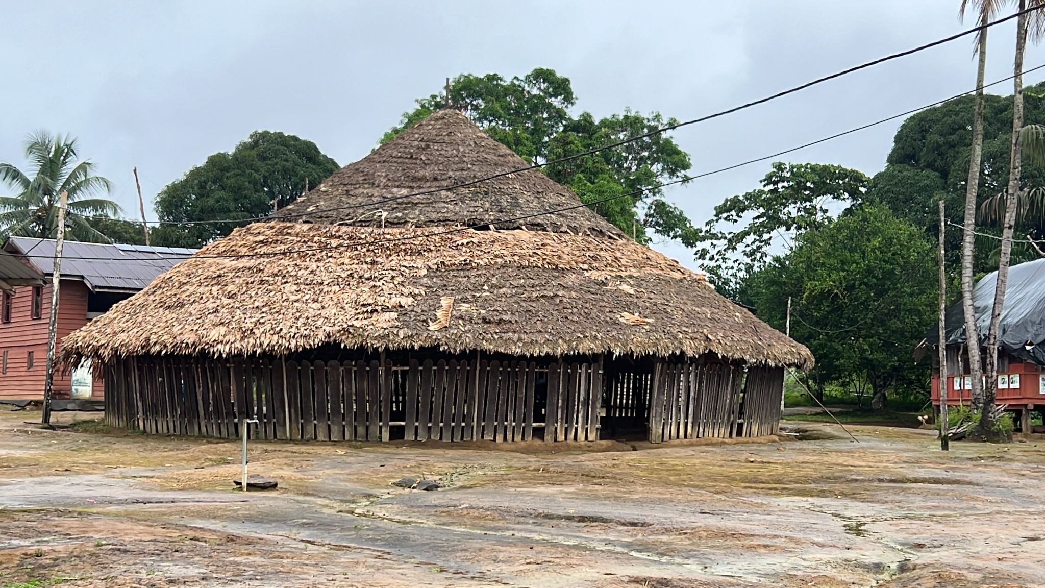
In the field in south Suriname! Exciting new work with the community in Pelelu Tepu on the Tapanahoni River.
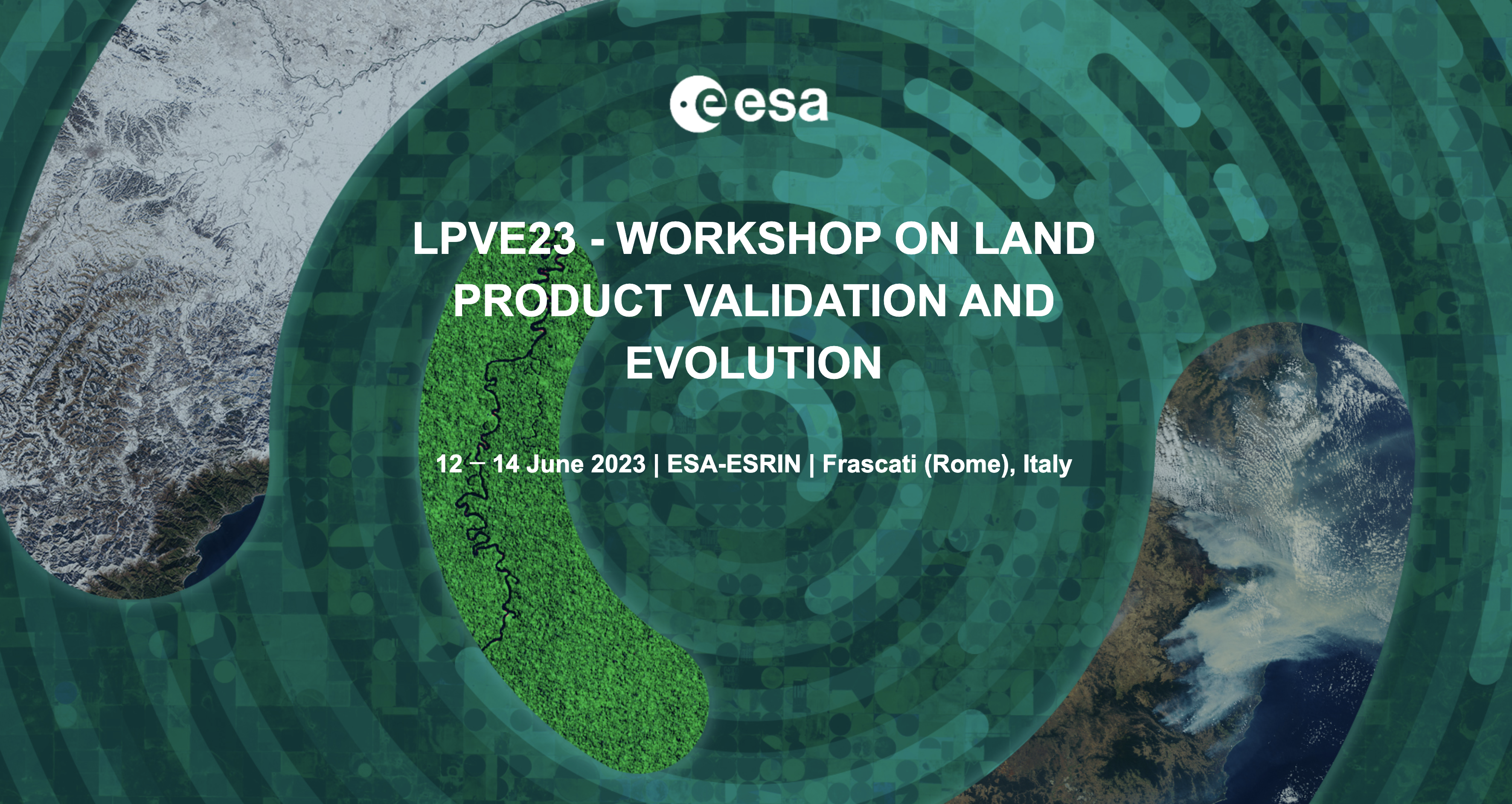
Getting ready for the Land Product Validation and Evolution Workshop! Two presentations, a poster and a workshop on flight planning.
UAS Hyperspectral (UAS-HSI) data collection best practices and implementation of the spatial response resampling methodology for cal/val.
Multispectral UAV sensor limitations in mapping complex vegetation and satellite validation
The Canadian Airborne Biodiversity Observatory (CABO) Standardized Cal/Val practices for biodiversity assessment at different spatial scales from hyperspectral remote sensingHigh resolution 3D model of the Poás volcano, Costa Rica!
We completed several UAV flights over the Poás volcano in Costa Rica in collaboration with OVSICORI, the McGill Volcanology Research Group, UNED and NRC to generate a very high resolution model of the active sector of the crater. Check it out here!
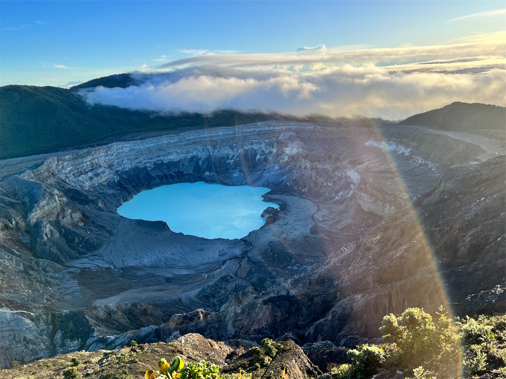
View our YouTube video about the expedition here.
We specialize in:
- Unmanned Aerial Systems (UAS) integration
- Hyperspectral data
- Airborne imagery
- LiDAR
- Thermal imaging
- SfM photogrammetry
- Regional-scale satellite image analysis
- Cubesat image analysis
- Data fusion
- Virtual reality visualization
Check out all our highlights through our most recent social media posts!
Our ongoing research and student training opportunities have been made possible by the financial and logistical support from the following organizations:


Applied Remote Sensing Lab
Department of Geography
McGill University
805 Sherbrooke West
Burnside Hall 305
Montreal, QC H3A 0B9
Canada
Project
About Us
Newsletter
Coming soon!